Field Engineering using CAD & GIS Consulting Projects Geoprocessing Application for School Districts & Banks Waterborne Intruder Detection System Undergraduate & Graduate Schools Space Oblique Mercator Map Projection Aircraft Performance Measuring System Aircraft Performance Measuring System Aircraft Performance Measuring System Automated Map Measurements Raster GIS, Remote Sensing, Image ProcessingProgramming Collaboration via NetMeeting Field GIS for Exploration Geologists Digital Terrain Modeling GIS Driver overSatellite Imagery Devide-Independent Graphics PackageAircraft Maintenance Officer T-Mobile 2006 Store Survey Database National Security Reconnaissance Photos Research Scientist - Radar/Comp. Sci./Electromagnetics T-Mobile 2006 Store Survey Database Field Engineering using CAD & GIS

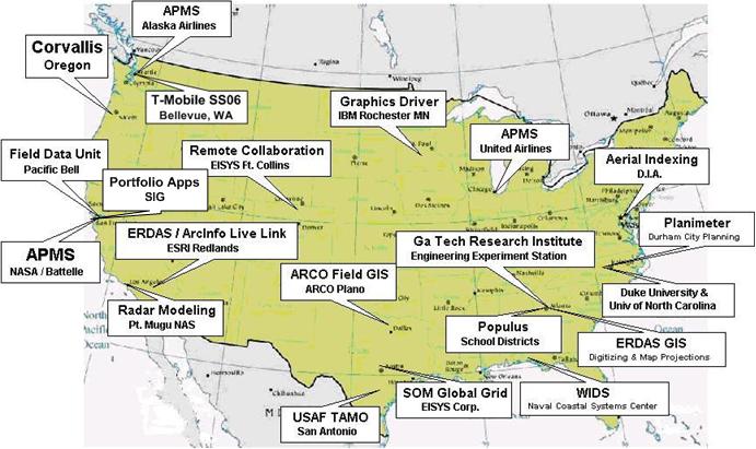
CLICK TITLE TO VIEW PROJECT DESCRIPTION